Urban Climate Analysis
-
Analyze the urban climate impact of modern urban planning.
Compare population density and vegetative health in Reston, VA, to neighboring towns.
Utilize H3 indices to align datasets with different resolutions for accurate comparison.
Assess how urban design influences environmental sustainability.
-
Independent researcher
-
August-October 2023; awaiting publishing
-
Python for data processing and analysis.
H3 spatial indexing for uniform dataset alignment.
Geographic and climate data sources for urban planning insights.
Data visualization to interpret population density and vegetative health trends.
-
Successfully aligned disparate datasets for a consistent comparison.
Identified key urban planning factors affecting climate sustainability.
Demonstrated the effectiveness of H3 indexing in urban analysis.
Provided insights on balancing urban density with environmental health.
Introduction
I had long heard that Reston is recognized for its urban planning, with green spaces legally defined in its development framework. However, I was curious to examine the quantitative environmental impact of these design choices.
Study Overview
To analyze this, I conducted a study using NASA and GCIS indices, overlaying temperature and vegetative health data with population density in Reston and a neighboring town.
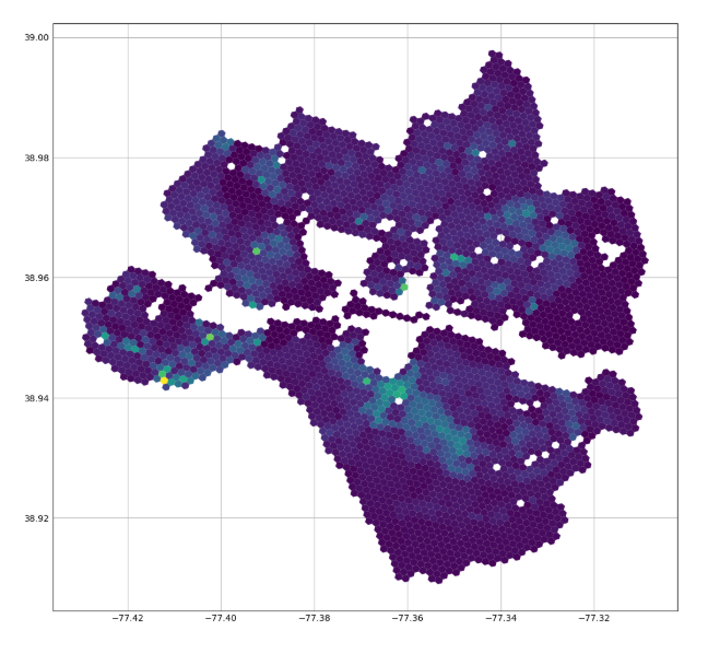
Since some areas of both towns are unpopulated (e.g., highways, airports, etc.), they were removed from the dataset (Figure 3) to ensure a more accurate analysis.
Key Findings
For the same population density, Reston’s green development correlates with better vegetative health and lower temperature averages.
This suggests that planned green spaces can mitigate urban heat effects and support ecological health.
Challenges & Methods
Data Disparity: NASA and GCIS data sets had different spatial resolutions, making direct comparisons difficult.
Solution: I used H3 hexagon spatial indexing, averaging values within each hexagon to standardize the data across both datasets.
Tools: Python, H3 indexing, geographic data visualization.
Conclusion
By using a spatially consistent method, I demonstrated that Reston’s urban planning positively impacts environmental sustainability. This study highlights the importance of integrating green infrastructure into urban development.
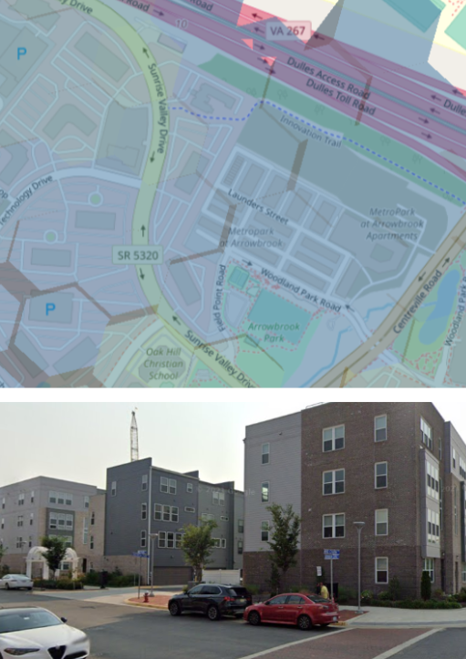
Figure 1: An instance of modern urban development lacking green space—correlating with low vegetative health and higher temperatures despite having the same population density as the neighboring town, Reston.
Figure 2: Demonstration of data compilation for both towns, with unpopulated areas removed for accurate analysis.


